Speed Review
About the Consultation
How to have your say
FAQs
proposed speed changes
documents
Have Your Say on Carterton’s road speeds
Consultation is now open
Share your feedback on our proposed Speed Management Plan by midnight, Sunday 17 August.
What’s happening?
Carterton District Council is proposing changes to speed limits on a number of local roads. Our Speed Management Plan outlines where we are proposing to lower speed limits and how we plan to implement those changes.
The plan prioritises safer speeds around schools, marae, and high-risk routes to ensure that everyone using our roads – whether walking, biking, or driving – can do so safely. We want to make sure the right speeds are in place on the right roads, based on how people actually use them.
We are also reviewing the proposals we consulted on in 2023 to ensure they are still appropriate in 2025. Some new roads have also been included for consideration.
Have Your Say
Frequently Asked Questions
Will speed limits on state highways change as part of this consultation?
No. This consultation only covers roads controlled by Carterton District Council. State Highways are managed by Waka Kotahi NZ Transport Agency and are not included in the plan.
Can you use my submission from the 2023 Speed Review consultation?
No. This is a separate consultation, and only feedback received through this current process can be considered. However, feedback from the 2023 consultation has helped shape many of the proposals in this plan and is reflected in the supporting information. Because the 2024 Rule introduced new requirements and adjustments, we encourage you to review the updated proposals and share your feedback.
What is the Speed Management Plan?
The Speed Management Plan is a formal document that sets speed limits across the Carterton district. It explains where speed limits are proposed to change, why those changes are being made, and how they will be implemented. It focuses on safety for all road users, particularly around schools and high-risk locations.
Why are we consulting again?
The Land Transport Rule: Setting of Speed Limits 2024 introduced a new framework and additional requirements for councils. Although Carterton District Council consulted on speed changes in 2023, we are required to undertake this new consultation process to meet the new legislative requirements, including a six-week formal consultation period and certification by the Director of Land Transport.
When will the new speed limits be implemented, and when will new signs go up?
Once the consultation closes on 17 August 2025, Council will consider all feedback and finalise the Speed Management Plan. This includes updating any proposals based on community input and completing the required summary of submissions.
The final plan will then be submitted to the Director of Land Transport for certification. This is a legal requirement under the Land Transport Rule: Setting of Speed Limits 2024. Only once certified can the new speed limits be implemented.
We expect certification to take place in September or October 2025, with new speed limit signs being installed between late 2025 and early 2026.
New limits only take legal effect after signage is installed and the changes are recorded in the National Speed Limit Register. Until then, current speed limits remain enforceable.
How were the proposed changes decided?
The proposals were developed based on feedback from past consultations, crash and traffic data, road use patterns, and technical assessments including cost-benefit analysis. The plan also reflects priorities set out in the national Rule and supports safer journeys for all.
What happens if I don’t agree with the proposed changes?
Your feedback is still important. You are welcome to state which changes you support and which you don’t. All submissions are reviewed and summarised in a report to elected members, who use this information to inform their final decisions.
What speed limits or roads have changed since the 2023 consultation?
A summary of the changes from the 2023 consultation can be found in the supporting documents section at cdc.govt.nz/consultations.
Speed Management Plan: Proposed Speeds Changes
| Road Section | Existing Speed (km/h) | Proposed Speed (km/h) | Speed Limit Type | Urban/Rural |
|---|---|---|---|---|
| Lincoln Road between 185m southwest of Victoria Street and Dalefield Road | 70 | 50 | Permanent | Urban |
| Dalefield Road between SH2 and 75m northwest of Lincoln Road | 70 | 50 | Permanent | Urban |
| Dalefield Road between 75m northwest of Lincoln Road and road end | 100 | 80 | Permanent | Rural |
| Watersons Line between Dalefield Road and 250m southwest of Dalefield Road | 100 | 60 | Permanent | Rural |
| Thomas Road between Dalefield Road and 250m northeast of Dalefield Road | 100 | 60 | Permanent | Rural |
| Belvedere Road between Lincoln Road and the bridge | 70 | 50 | Permanent | Urban |
| Belvedere Road between the bridge and Mannings Road | 100 | 80 | Permanent | Rural |
| Hodders Road | 100 | 80 | Permanent | Rural |
| Moreton Road between 150m northwest of Rutland Road (at the existing 50/100 km/h speed limit change) and 50 m southeast of Rutland Road | 100 | 60 | Permanent | Rural |
| Moreton Road between 50m southeast of Rutland Road and Carters Line | 100 | 80 | Permanent | Rural |
| Rutland Road between Hilton Road and Park Road | 100 | 60 | Permanent | Rural |
| Park Road between 205m southeast of Dixon Street (at the existing 50/100 km/h speed limit change) and 50m southeast of Rutland Road | 100 | 60 | Permanent | Rural |
| Park Road between 50m southeast of Rutland Road and Carters Line | 100 | 80 | Permanent | Rural |
| Richmond Road between 50m southeast of Deller Drive (at existing 50/70 km/h speed limit change) and Rutland Road | 70 | 60 | Permanent | Urban |
| Hilton Road between 25m southeast of Madison Street (at the existing 50/100 km/h speed limit change) and Rutland Road | 100 | 60 | Permanent | Rural |
| Johnsons Road | 100 | 80 | Permanent | Rural |
| Waitangi Road | 100 | 80 | Permanent | Rural |
| Baylys Road | 100 | 80 | Permanent | Rural |
| Hughes Line between SH2 and end of road | 100 | 80 | Permanent | Rural |
| Cornwall Road between SH2 and Hughes line | 100 | 80 | Permanent | Rural |
| East Taratahi Road between SH2 and Hughes Line | 100 | 80 | Permanent | Rural |
| Chester Road between SH2 and 1.7 km north of SH2 | 100 | 60 | Permanent | Rural |
| Norfolk Road between SH2 and 800m northwest of SH2 | 100 | 60 | Permanent | Rural |
| Waingawa Road | 100 | 60 | Permanent | Rural |
| Norman Avenue | 100 | 60 | Permanent | Rural |
| Ahumahi Road | 100 | 60 | Permanent | Rural |
| Pakihi Road | 100 | 60 | Permanent | Rural |
| Gladstone Road between 2.8km north of Te Whiti Road and 3.6km north of Te Whiti Road | 100 | 30 | Variable | Rural |
| Gladstone Road between Te Whiti Road and 3.6km northwest of Te Whiti Road | 100 | 80 | Permanent | Rural |
| Te Whiti Road between 50m south of Gladstone Road and northern end of Tauweru River Bridge | 100 | 80 | Permanent | Rural |
| Kokotau Road | 100 | 80 | Permanent | Rural |
| Millars Road | 100 | 80 | Permanent | Rural |
| Mount Holdsworth Road | 100 | 80 | Permanent | Rural |
| Waiohine Gorge Road | 100 | 80 | Permanent | Rural |
| Matarawa Road between SH2 and end of road | 100 | 80 | Permanent | Rural |
| Moffats Road between Matarawa Road and Jervois Road | 100 | 80 | Permanent | Rural |
| Beef Creek Road | 100 | 80 | Permanent | Rural |
| Jervois Road | 100 | 80 | Permanent | Rural |
| Watersons Line between Matarawa Road and 250m southwest of Dalefield Road (start of 60 km/h) | 100 | 80 | Permanent | Rural |
| Admiral Station Road between Admiral Road and end of road | 100 | 80 | Permanent | Rural |
| Arcus Road between Dalefield Road and end of road | 100 | 80 | Permanent | Rural |
| Barley Flat Road between Te Wharau Road to end of road | 100 | 80 | Permanent | Rural |
| Belvedere Road between 430m north of Hoeke Road to Cobden Road | 100 | 80 | Permanent | Rural |
| Bismark Road between Kaiwhata Road and end of road | 100 | 80 | Permanent | Rural |
| Blakes Road between Norfolk Road and end of road | 100 | 80 | Permanent | Rural |
| Buchanan Road between Te Kopi Road and end of road | 100 | 80 | Permanent | Rural |
| Camerons Road between Te Wharau Road and Glenburn Road | 100 | 80 | Permanent | Rural |
| Clifton Grove Road between Admiral Road and Wainuioru Road | 100 | 80 | Permanent | Rural |
| Craigie Lea Road between Te Wharau Road and end of road | 100 | 80 | Permanent | Rural |
| Dakins Road between 1.93km south of East Taratahi Road to end of road | 100 | 80 | Permanent | Rural |
| Driscoll Road between Te Wharau Road and Forest Glen Road | 100 | 80 | Permanent | Rural |
| Eringa Road between Longbush Road and end of road | 100 | 80 | Permanent | Rural |
| Flat Point Road between Te Wharau Road and end of road | 100 | 80 | Permanent | Rural |
| Foreman Jury Road between Ponatahi Road and end of road | 100 | 80 | Permanent | Rural |
| Forest Glen Road between Driscoll Road and end of road | 100 | 80 | Permanent | Rural |
| Glenburn Road between Te Wharau Road and end of road | 100 | 80 | Permanent | Rural |
| Hilton Road between Rutland Road and Marshall Road | 100 | 80 | Permanent | Rural |
| Hinau Gully Road between Cobden Road and end of road | 100 | 80 | Permanent | Rural |
| Hughes Line between Cornwall Road and Waingawa River (end of road) | 100 | 80 | Permanent | Rural |
| Kaiwhata Road between Te Wharau Road and Kaihoata River (CDC/MDC boundary) | 100 | 80 | Permanent | Rural |
| Mahupuku Road betweeon Longbush Road and end of road | 100 | 80 | Permanent | Rural |
| Mangatarere Valley Road between 50m south of McLennans Road and end of road | 100 | 80 | Permanent | Rural |
| Marshall Road between Park Road and Waihakeke Road | 100 | 80 | Permanent | Rural |
| Mclennans Road between Mangatarere Valley Road and end of road | 100 | 80 | Permanent | Rural |
| Perrys Road between 520m north of East Taratahi Road and end of road | 100 | 80 | Permanent | Rural |
| Perrys Road (Sth) between Francis Line and 630m south of East Taratahi Road | 100 | 80 | Permanent | Rural |
| Portland Road between 150m south of SH2 (at the end of seal) to Marshall Road | 100 | 80 | Permanent | Rural |
| Puketiro Road between Te Wharau Road and end of road | 100 | 80 | Permanent | Rural |
| Rocky Hill Road between Te Wharau Road and end of road | 100 | 80 | Permanent | Rural |
| Ruakiwi Road between Te Wharau Road and end of road | 100 | 80 | Permanent | Rural |
| Short Road between Park Road and Somerset Road | 100 | 80 | Permanent | Rural |
| Te Awa Road between Te Kopi Road and end of road | 100 | 80 | Permanent | Rural |
| Te Wharau Road between 50 m north of Driscoll Road to Flat Point Road | 100 | 80 | Permanent | Rural |
| Tea Creek Road between Mangatarere Valley Road and end of road | 100 | 80 | Permanent | Rural |
| Tiffin Road between 160m west of Gladstone Road to Tiffin Hill Road | 100 | 80 | Permanent | Rural |
| Udy Street between Marshalls Road and end of road | 100 | 80 | Permanent | Rural |
| Waihakeke Road between Taumata Island Road and end of road | 100 | 80 | Permanent | Rural |
| Waimana Road between Admiral Road and end of road | 100 | 80 | Permanent | Rural |
| Waipopo Road between Te Whiti Road and end of road | 100 | 80 | Permanent | Rural |
| Brooklands Road between Te Whiti Road and end of road | 100 | 80 | Permanent | Rural |
| Opuakaio Road between Kokotau Road and end of road | 100 | 80 | Permanent | Rural |
| Hoeke Road between Belvedere Road and end of road | 100 | 80 | Permanent | Rural |
Documents
| Title | Date | Link |
|---|---|---|
| Carterton Safety & Speed Data Summary 2025 | 7 July 2025 | |
| Cost Benefit Statements Speed Limit Proposals | 7 July 2025 | |
| Carterton District Draft Speed Management Plan | 7 July 2025 | |
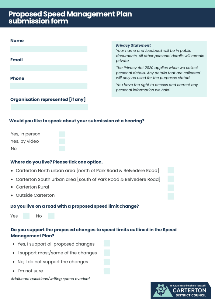
| Submission form: Speed management plan consultation | 1 July 2025 | |
| Speed Management Review Statement of Proposal [including form] | 1 July 2025 |


